RPM AERIAL SERVICES
Geospatial
RPM Aerial offers comprehensive surveying solutions tailored to meet the diverse needs of our clients, guaranteeing the most precise, efficient and versatile solution for every situation.
Topographic Surveys
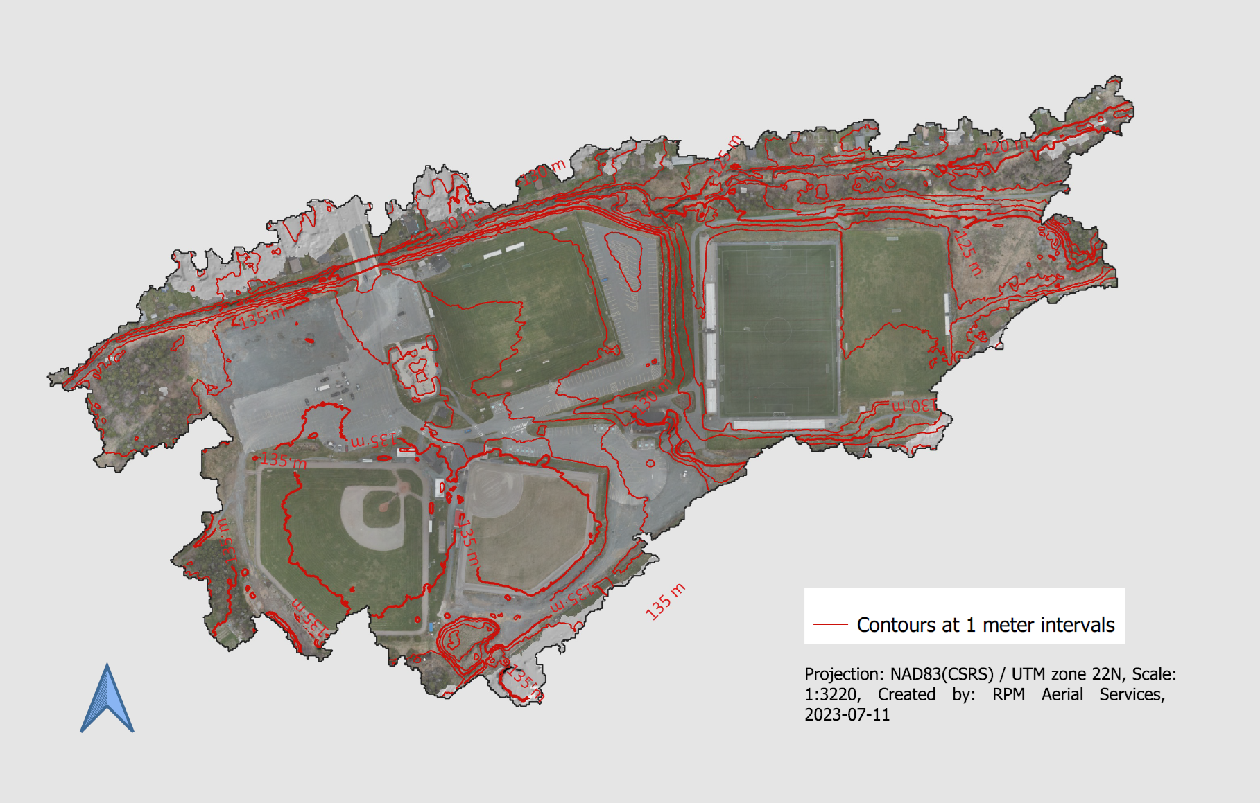
RPM Aerial works with professionals across a wide variety of sectors, including architects, engineers, and contractors. Providing services for both large and small-scale construction and engineering projects, as well as for land development and transportation infrastructure mapping. No matter the scale of your project, RPM is the company of choice for your topographic surveys.
A topographic survey is often required for design purposes, including new construction and improvements and upgrades for industrial, commercial, and residential applications. A well-defined topographic plan will help guide architects, engineers, and contractors in the planning and construction phases.
Normally completed at the start of a project, a topographical survey typically includes measurements of features/terrain including structures such as roads, buildings, communications, and utility towers. RPM will also gather data on natural elements such as trees, rivers, streams, and hillsides in the area being surveyed. RPM can create a variety of deliverables including “bare earth models” to show you exactly what terrain lies underneath vegetated areas.
When a project has moved past the preliminary stage, RPM Aerial can introduce our Land Surveying team to provide accurate and reliable data. These types of surveys can be used for a variety of purposes including grading and other design requirements, volume calculations, or locating existing buildings and other critical features in the project area.

3D City & Infrastructure Modeling
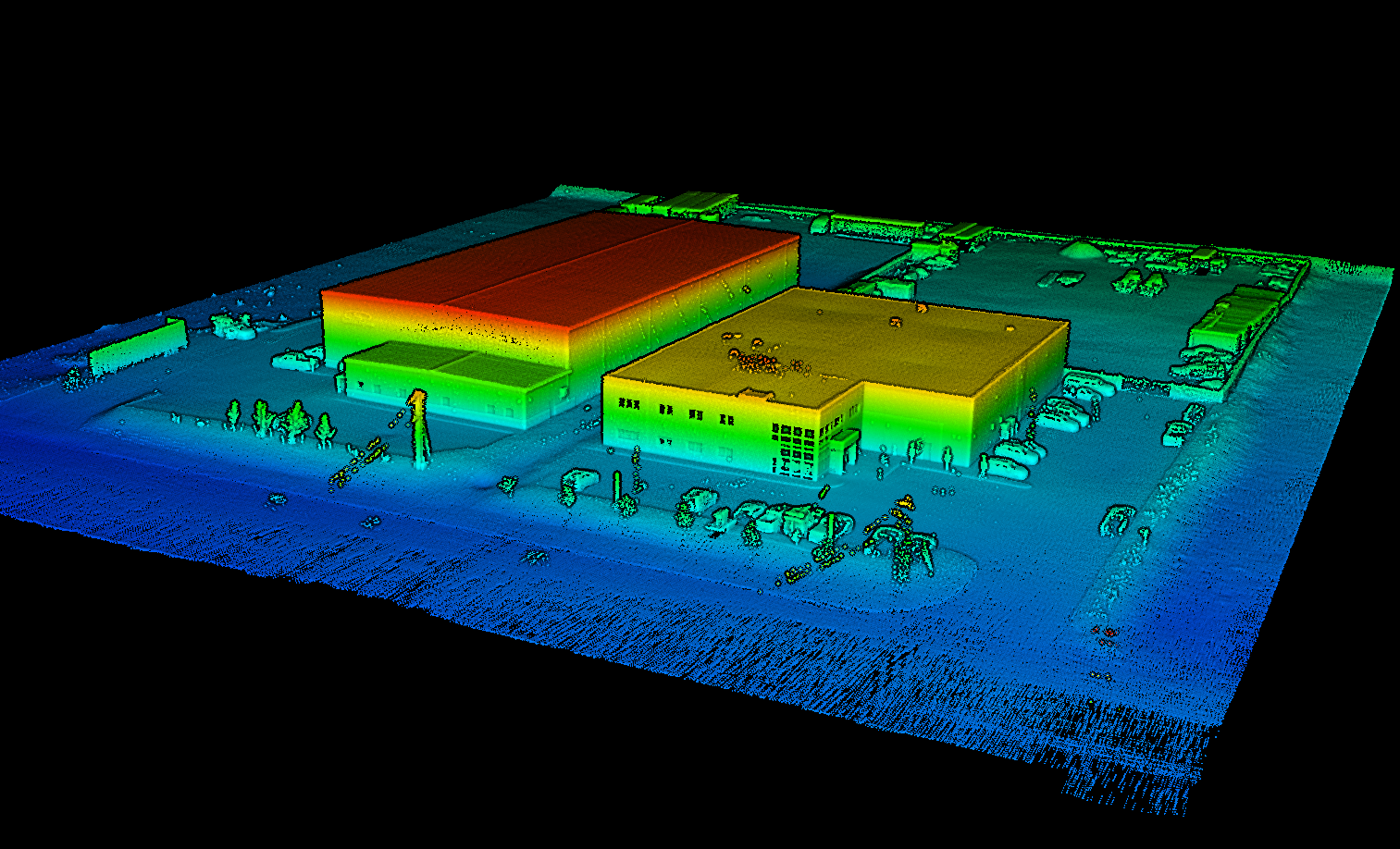
Looking to capture every nuance of your municipality and integrate asset management into the picture? RPM Aerial has you covered. Let us collect highly detailed LiDAR-based survey data to allow your team to manage your municipality from the comfort of their desk. RPM has a highly skilled team of data processors who will class out any and all infrastructure you require such as fire hydrants, curbs, and culverts to name a few.
RPM also works closely with engineering firms, and utilities to scan other types of infrastructure including but not limited to substations and switchyards. Not only using the latest aerial technology, but we can also employ the services of our sister company RPM Geospatial to utilize additional land-based systems and techniques to provide you with digital twins of interior spaces or difficult areas such as around densely populated city areas that are GPS/GNSS denied, providing you with robust and accurate data sets.
As-Built Surveys
An As-Built survey is a geometric undertaking conducted on a road, building or other infrastructure, and can be done both during and after construction is complete. At RPM Aerial, we can produce highly accurate 3D models that detail the project at a precise moment in time. An As-Built survey may also be used to verify, through the As-Built drawings, the correlation between the approved project and what was built.
In general, an As-Built model shows the exact position of the structural, mechanical, electrical, and architectural elements of buildings, or elements of roadways to be upgraded, the completion of new road construction projects, and to provide a complete picture of the project at the time of the survey.
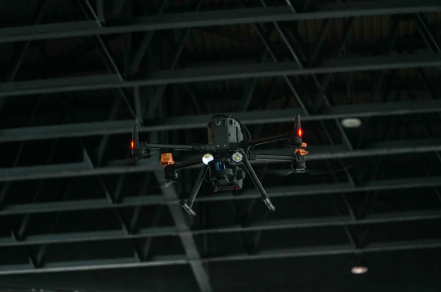
The process of creating an As-Built model starts with an advanced geometric LiDAR survey of the infrastructure to be modeled. The collection of this data may utilize multiple methods including Helicopter LiDAR systems, RPAS/Drone LiDAR systems, as well as land-based technologies like Mobile-Mapping, Hand-Held LiDAR systems, Tripod-based LiDAR systems, and traditional survey techniques.
The combined services of RPM Aerial, and its sister company RPM Geospatial can bring to bare a comprehensive suite of technologies to complete all your As-Built survey needs.

Photogrammetry Services
Photogrammetry is a cost-effective technique often used when there is a need to capture visual details of an area. Photogrammetry can be used to produce Orthomosaic Maps of broad areas and has a number of potential uses ranging from traditional site surveys and management applications, or as a rapid deployment tool in disaster management and public safety.
Photogrammetry is the process of using overlapping photographs to create an Orthomosaic Map, or 3D model of existing objects or locations, and is one of the oldest forms of visual surveying. Over the years, the applications for Photogrammetry have evolved and is now often used in volumetrics, the production of 3D models, mineral exploration programs and environmental applications.
Photogrammetry can also be fully georeferenced and overlaid on other data sources such as Google Earth imagery, as seen in the image below.
Likewise, at the request of clients, RPM Aerial will often utilize photogrammetry to accurately colourize LiDAR point-clouds, thus helping with interpretation or for presentations whereby LiDAR data in-itself may be unclear to the untrained eye.


Vegetation Encroachment Surveys
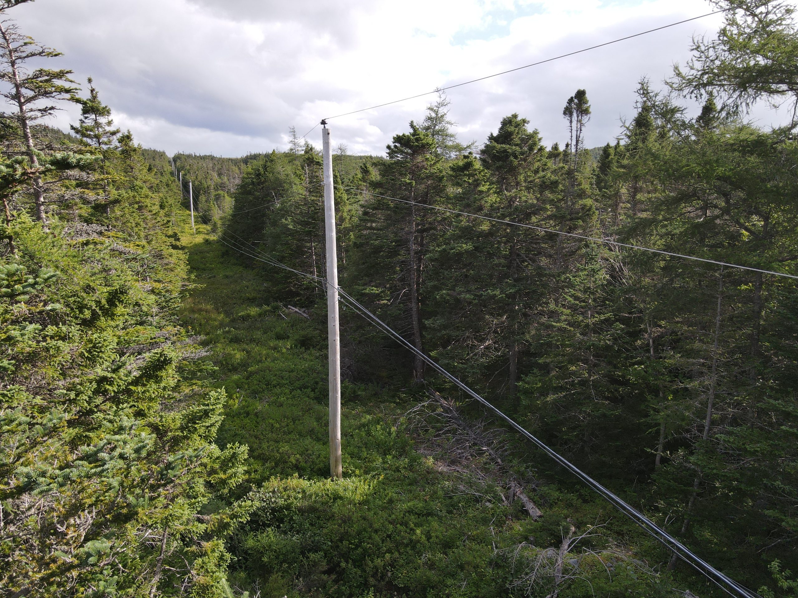
Vegetation encroachment in power transmission and distribution networks pose a major hazard not only for the environment and the networks’ integrity, but also for society in general, with potentially fatal consequences. On occasion, the vegetation near power lines, combined with aging infrastructure, can cause, and spread fires leading to large-scale disasters. Additionally, power disruptions can have far reaching consequences ranging from localized outages, resulting in mild inconveniences to complete cascade failures spanning not only provincial boarders, but internationally and result in devastating consequences. Therefore, conducting yearly vegetation encroachment monitoring programs should be a critical part of utilities monitoring and maintenance schedules.
There are several methods available for monitoring vegetation encroachment, of which the most basic and time consuming is the “Patrol inspection”. This type of inspection is one of oldest and most unreliable monitoring techniques, whereby two or more people are tasked with walking sections of power corridors to conduct visual vegetation inspections. This technique is not only time-consuming but also highly inaccurate with the identification of potentially dangerous vegetation encroachment being speculative and more of a guesstimate at best.
To mitigate this risk and to ensure robust and reliable networks, RPM Aerial utilizes both Helicopter and RPAS/Drone based LiDAR services to produce highly accurate 3D models of complete power and communication corridors to identify locations of vegetation encroachment. These datasets can be used to identify the height of vegetation within a power corridor for vegetation management activities, also to identify taller vegetation along the sides of corridors, vegetation that when fell can make contact with critical infrastructure. Additionally, ongoing LiDAR surveys can be used to run predictive models to determine growth rates and better predict future survey schedules and vegetation management.
Power Line Clearance Surveys
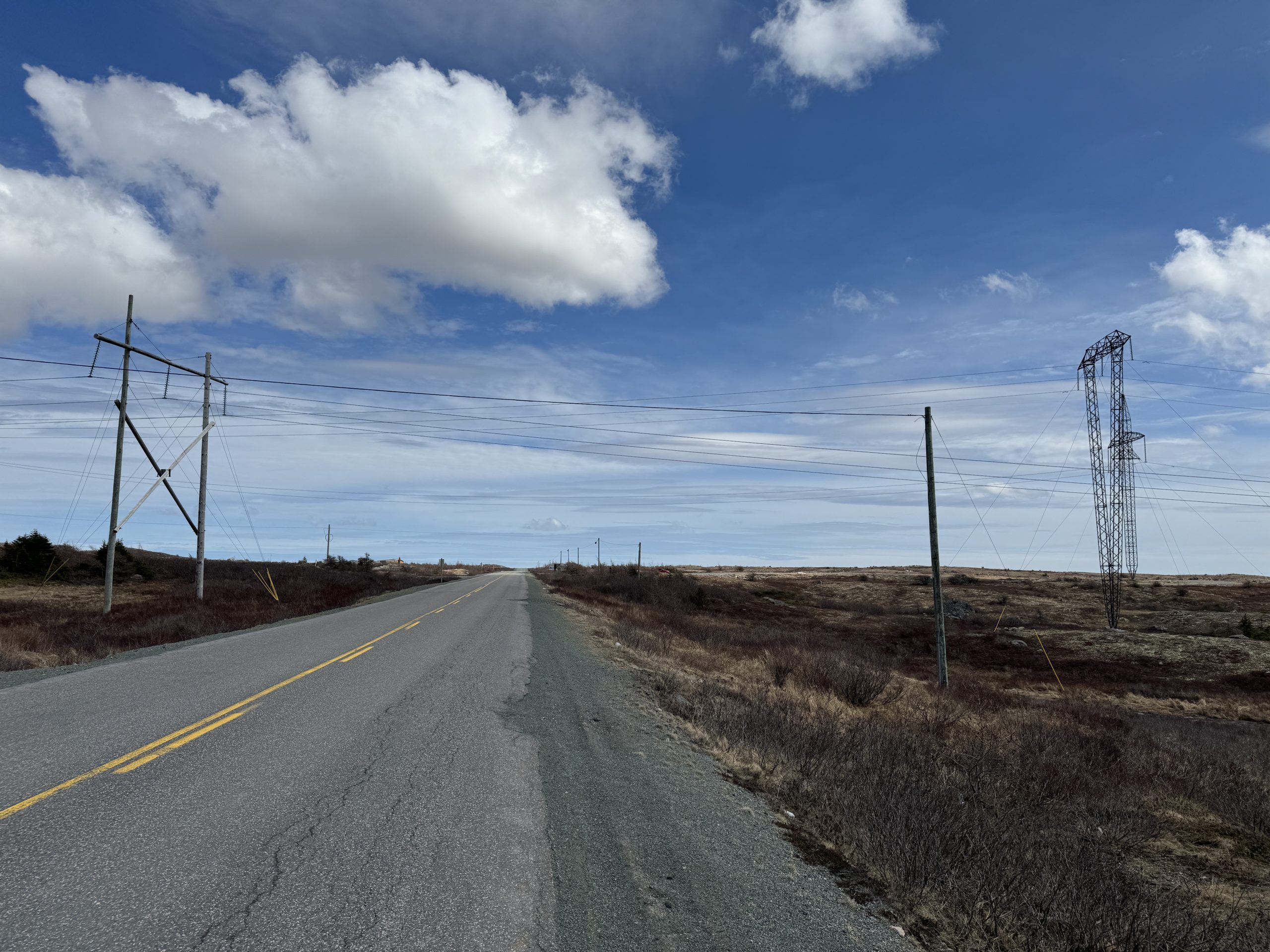
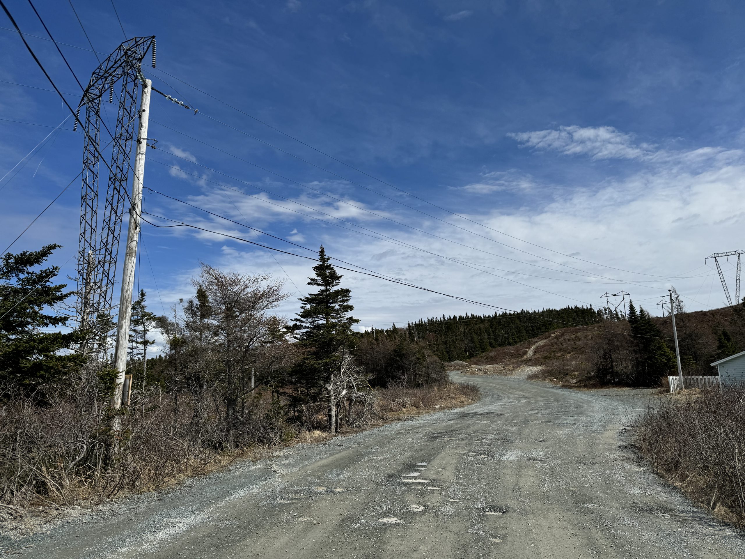
The nature of power transmission and distribution, combined with sprawling road networks and ongoing development often conflict at areas of intersection, and the requirement to maintain safe clearances can be challenging.
Whether moving large equipment along urban or rural roadways, or when planning new road construction that may cross under existing powerlines, measuring, and maintaining safe clearances are critical.
Much like vegetation encroachment, RPM Aerial offers a variety of methods to model key sections of power corridors to ensure safety is maintained every step of the way.
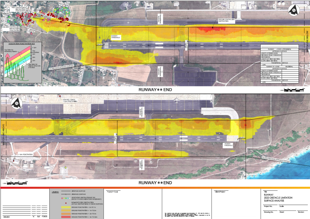
Obstacle Limitation Surface (OLS) Survey
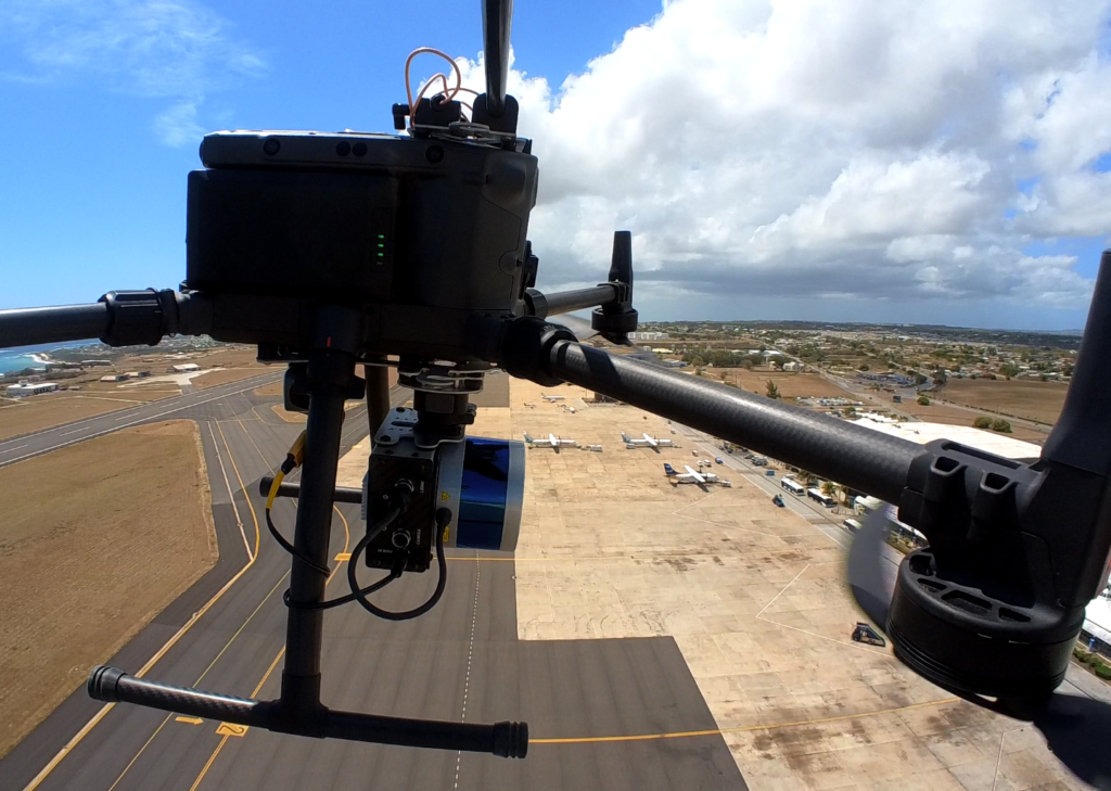
Often abbreviated as OLS surveys, RPM Aerial conducts Obstacle Limitation Surface Surveys to assess the potential risk to aviation within designated airspace. We employ the use of aerial LiDAR, and Mobile Mapping techniques (via RPM Geospatial) to identify and map obstacles such as buildings, towers, trees, and terrain features that could pose a hazard to air traffic. OLS surveys play a crucial role in the planning and development of airspaces, airports, and flight paths to ensure that aviation operations can be conducted safely and efficiently.
Additionally, the data collected by RPM Aerials sister company RPM Geospatial via Mobile Mapping, can be used to identify and model cracks, runway markings, signage, lighting, ruts, grading, water drainage, and much more.
Underground Mapping / Modeling
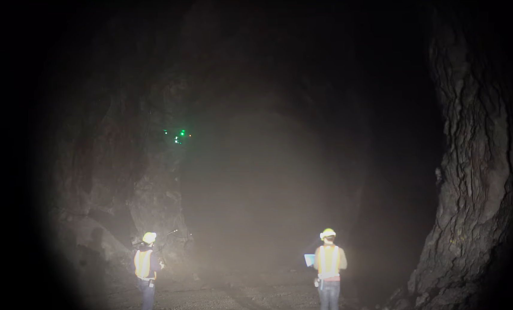
RPM Aerial can map your GPS/GNSS denied underground environments utilizing various LiDAR based mapping technologies. These technologies can include a fully autonomous aerial system, or the use of tripod and/or hand-held/backpackable LiDAR based technologies as provided by RPM Aerial’s sister company, RPM Geospatial. This suite of technologies is perfect for modeling underground mines, and critical infrastructure such as electrical systems and ventilation, or for modeling hydro powered system such as large penstocks and caves. Your staff will be able to access important data via the comfort of their desk, increasing safety and efficiency.
Let RPM Aerial capture your data with accuracy and precision, enabling you to run your operation safely and effectively.
