WELCOME TO
RPM Aerial Services
Trust the Experts in Geospatial Data Collection
At RPM Aerial, we’re committed to providing our clients with exceptional geospatial/geophysical data by leveraging the latest surveying and sensor technology. This commitment to technical excellence unlocks critical insights and solutions for our clients’ most important projects, providing them with measurable, dependable data with unparalleled accuracy. From detailed land surveys using LiDAR technology, comprehensive infrastructure inspections, or magnetometer surveys, we deliver crucial data for industries ranging from construction and engineering to environmental conservation and mineral exploration.
Our Mission
Our mission is straightforward: To provide clients with cost-effective solutions to difficult problems by utilizing cutting edge geospatial and geophysical technologies and techniques.
Customization
Suitable for a wide range of applications, from topographic mapping and forestry management to urban planning and infrastructure projects.
Accuracy
Our technology produces highly accurate data, even in complex environments like densely forested areas or urban landscapes.
Efficiency
With the ability to cover large areas quickly and significantly reduce the time needed for surveying tasks compared to traditional methods.
Over
Hectares Covered
Over
Data Points Collected
Our Services
Ready to Elevate Your Project?
Discover how RPM Aerial can bring your project to new heights. Explore our services to learn more about what we offer or contact us today to discuss your specific needs with our experienced team. Let us elevate your project by blending the world’s best technology with our expert operators to achieve outstanding results.
Geospatial
- Topographic Surveys
- 3D City & Infrastructure Modeling
- As-Built Surveys
- Photogrammetry Services
- Vegetation Encroachment Surveys
- Powerline Clearance Surveys
- Obstacle Limitation Surface (OLS) Surveys
- Underground Mapping & Modeling
Geophysics
- Magnetometer Surveys
- VLF Surveys
- TDEM Surveys
- Radiometric Surveys
- Gravity Surveys
Inspection Services
- Powerline Inspections
- Communication Tower Inspections
- Infrastructure Inspections
Other Services
- Offshore Operations
- Water Leak Detection
- Buried Infrastructure Detection
- Ground Anomaly Detection
- Custom Integration
- Specialized Operations
Why Choose RPM Aerial?
Advanced Technologies
Our industry-leading solutions are delivered through a range of aerial surveying methods, including LiDAR, photogrammetry, magnetometry, and more. We can avail of our arsenal of in-house technology to not only enhance your project, but also deliver data in a format that is agile and easy for our clients to navigate.
Expert Team
Our experts bring a wealth of knowledge and experience in aerial surveying, ensuring that you get exactly what you need for your project. Our flight team all possess advanced RPAS certificates, and our partnership with Newfoundland Helicopters provides us access to the best pilots in the industry.
Customized Solutions
We understand that each project is unique and will work closely with you to develop customized solutions that address your specific challenges and goals whether we are utilizing RPAS or helicopter mounted technology.
Commitment to Safety and Compliance
We prioritize safety and regulatory compliance in all our operations, ensuring that our practices meet the highest industry standards. RPM Aerial is COR certified and completes every job by the book, safely and professionally.
On-Time & On-Budget
RPM understands and respects the need for precise project planning and budgeting. Just as important is the need for contractors to bid cost-effectively and responsibly so projects remain on time and on budget. At RPM, we pride ourselves on quoting projects accurately and responsibly with a 99% accuracy rate in delivering projects on time, and within quoted budgets!
RPM does not believe in, nor participate in “Cost Plus” quoting!
Calibre Mining Corp
RPM has been a frequent supplier of Geospatial and Geophysical surveys for our projects, not only providing timely and excellent service, but always executing projects on time and on budget. Having a supplier that can quote projects accurately and avoid cost overruns has been essential to managing our project budgets.
Nicholas Capps | Senior Exploration Manager at Valentine Gold Mine
Exploits Discovery Corp
RPM has remained Exploits’ preferred supplier of airborne Geospatial and Geophysical surveys since September 2022. RPM’s skilled and enthused team has consistently provided us with diligent, real-time service at a variety of exploration sites within central Newfoundland. RPM has completed all their assignments with safety, and cost-effectiveness at the forefront – I have 100% confidence in their data-quality and capabilities of delivering the final product to us on-time and on-budget.
Ken Tylee | VP of Exploration, Exploits Discovery
Trusted By

Our Commitment
At RPM Aerial, our paramount commitment is to safety, ensuring every operation meets the highest standards to protect our clients, team, and the environment. We’re dedicated to providing high-quality service, utilizing the latest in advanced technologies to deliver unparalleled accuracy and reliability. Understanding the unique needs of each project, we offer custom solutions tailored to ensure optimal outcomes in all regions and environments. As your trusted and valued partner, we’re not just service providers; we’re collaborators invested in your success. Our dedication extends beyond just meeting expectations—we aim to exceed them, driving innovation and excellence in every project we undertake.
Our Technology
At RPM Aerial, we leverage a comprehensive suite of advanced surveying technologies to provide our clients with precise and actionable data. Our toolbox includes numerous survey grade LiDAR systems for detailed topographical mapping, Magnetometers for subsurface exploration, Photogrammetry for high-resolution mapping and 3D modeling, VLF (Very Low Frequency) for in-depth geological analysis, and TDEM (Time-domain Electromagnetic) methods for identifying underground resources. These technologies enable us to deliver unparalleled insights into both the natural and built environment, supporting a wide range of industries with accurate, reliable data.
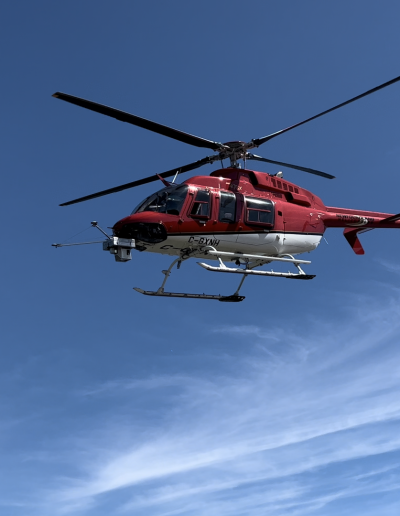
We’re not just about the tech, though; it’s how we deliver it that sets us apart. Our deployment methods are as advanced as our technologies, utilizing handheld devices for ground-level precision, drones for their versatility and ability to access challenging or remote areas, and helicopters for comprehensive area coverage. This multi-faceted approach ensures that no matter the project scope or complexity, RPM Aerial can provide tailored, efficient solutions that meet our clients’ specific needs. Dive deeper into our services to discover how we can elevate your projects with our cutting-edge technology and innovative deployment methods.
Careers
At RPM Aerial, we are continually seeking to expand our team with highly skilled professionals who are not only passionate about geospatial and geophysical data but the creation or integration of new technologies, systems or techniques that will provide better solutions for complex problems.
While we may not be actively advertising for a position, we welcome the interest of talented individuals in the following areas:
- RPAS/Drone Piloting
- Data Collection & Processing
- Geographic Information Systems (GIS)
- Surveying, and
- Advanced Data Management Techniques
If you believe your skills and expertise can enhance our dynamic team, we encourage you to reach out and join us in finding solutions today for tomorrows problems!


